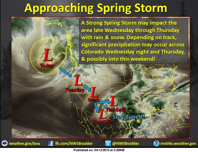
 There's no better way to wrap up the ski season than with bikinis and beer, unless, of course, you can eke out a bit of fresh snow. And that's what the National Weather Service is forecasting for later this week, as a juicy storm drops out of the Pacific Northwest toward Colorado.
Spring storms are notoriously hard to forecast, so need to unpack your powder snorkel just yet, but it appears likely that Copper Mountain will pick up at least a few inches of snow starting Tuesday night, with precipitation continuing on and off through the end of the week.
Right now, the storm is projected to drop south all the way to New Mexico and then wobble around for a few days. In that scenario, the heaviest snowfall will probably be east of, and along, the Continental Divide, with the most dumpage in places like Loveland, Arapahoe Basin and Winter Park, but the initial cold front Tuesday night should drop at least a few inches at Copper.
If the storm tracks just a little farther north, Copper and the rest of the resorts in Summit County could see more snow, but for now, forecasters are calling for anywhere between four and six inches in the Summit County mountains. Along with the snow, temperatures will drop, so if you're planning a ski trip, be sure to bring the winter gear along with shorts and Hawaiian shirts — you may need both on the same day!
And don't forget, it's Sunsation weekend at Copper, with free music, the Red Bull Slopesoakers contest and, of course, the infamous Eanie-Weenie Bikini contest for gals AND guys.
Filed in Copper Mountain News |